Shetland Islands 2015
Lunna to Out Skerries - Monday, 29th June
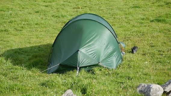
The wind was rattling the canvas and whilst it had obviously rained during the night, the sun was shining brightly through the walls of the tent. I'd been very comfortable and had slept well, which I put down to my new Alpkit sleeping bag that now cocooned me as I contemplated the day ahead.
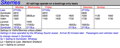
The plan was very basic, cycle back to Vidlin, find the ferry and sail to the Skerries. As part of my trip preparation, I'd used Google Earth to find likely spots for tonight's camp site and that was the only thing yet to be decided. I'd also downloaded the Skerries ferry timetable from the SIC website, which I'd found largely incomprehensible like all the others. |
 |
The Zetrans app however is brilliant and highly recommended. With the app's help, I'd deciphered the ferries' movements and devised my own timetable in order to plan the trip.
|
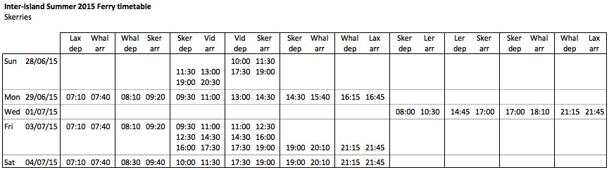 |
This had helped to identify possible alternatives for short visits to Skerries, but there was only one real option and this had defined the early part of my week. I was booked on the one o'clock ferry from Vidlin for the 90 minute crossing to Skerries, returning to Lerwick on Wednesday morning. I wasn't under any time pressure, although I needed to stock up for my two nights on Skerries.
The first priority was to try and dry my wet things from the day before. I'd laid out my jacket inside the tent during the night but everything was still very damp. I wished that I'd had a clothes line as there was a good drying breeze. In the end I spread some things across the bike and hung other stuff up on the croft walls, anchored down by large stones. |
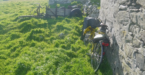 |
I placed the solar panel in the sunshine and connected it to the battery in the hope of replenishing some charge. Slightly more optimistic was the hope that my cycling shoes would dry off in the sunny breeze. For this trip, I'd decided that I needed a pair of walking shoes and the helpful guy in Cotswolds recommended the Salomon Escambia GTX. These 'approach' shoes were lightweight, waterproof and on special offer! Needless to say, they were proving very useful.
|
 |
I set to heating a foil bag of British Army beans 'n bacon and boiling water for a mug of tea, which was consumed whilst watching the fish service boats leaving their station for trips up the coast. The birds were making a cacophony around the croft; I'm not sure they were too happy with my presence. All in all, this really was a nice spot for an enjoyable breakfast.
|
 |
 |
The sunshine didn't last long and by 9.00 am the sky was beginning to look ominous. It never seems a good idea to me to pack up in the rain so with breakfast over and cleared away, I decided to break camp. My cycling gear had dried quite well, all except for the shoes which I put on reluctantly. I stacked the bags against the croft wall and started to take down the tent, leaving two pegs in on the windward side to stop it blowing away. The porch groundsheet was hung on a wall whilst I held up the bottom of the tent groundsheet to dry in the wind. I was very happy to get everything packed up whilst the rain held off.
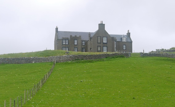
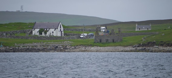
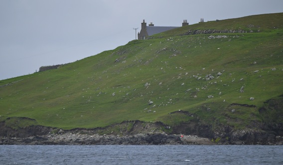
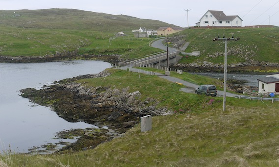
By 10.00 am, I was pushing the bike back over rough ground up to the road through the gate, leaving it as I'd found it. It was very damp and surprisingly cold in the headwind, so once more I covered my ears. I retraced the route back up the hill past the service base and along the tops towards Vidlin. I stopped to take a picture of Lunna House and Voe, enveloped by the low cloud. |
 |
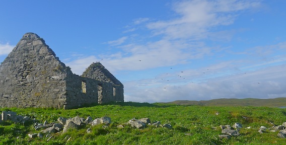
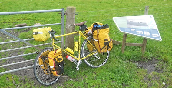
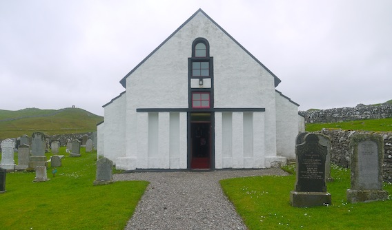
I zipped down the hill past Lunna House and on to the Kirk where I stopped for a closer look, leaving the bike by the Lunna interpretation board.
|
 |
The board gives information about the history of Lunna and what can be seen. It also describes the Shetland Bus operation "a secret convoy between Shetland and Norway during the German occupation of Norway in the Second World War. A base was established at Lunna House, from where small fishing boats smuggled saboteurs, radios, ammunition and explosives into the country."
I'd hoped to visit the Stanes of Stofast but the weather had put paid to that. The board explains, "this is a 2000 tonne glacial erratic, split in two by the frost. Like the nearby Lunning peninsula, this is a heavily glaciated landscape with eerily shaped rocks associated with the trows (trolls) of Shetland folklore."
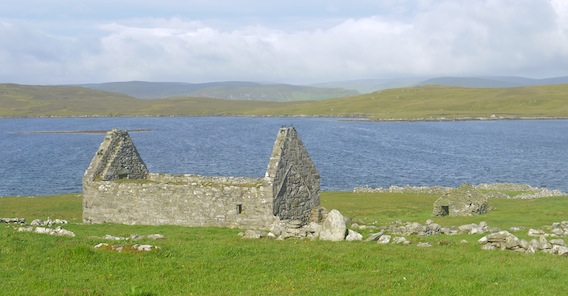
There were a few people looking around the Kirk and grave yard. I'd come to find the memorial dedicated to David Howarth which I found by the back wall, next to a memorial to Norwegian seamen lost at sea during the second world war. |
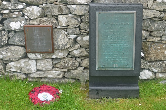 |
"In proud and loving memory of David Armine Howarth, 18th July 1912 - 2nd July 1991, naval officer, boatbuilder and author who from Lunna House and later from Scalloway, ran the shetland Bus operation from 1941 to 1945; who loved these islands dearly; and whose ashes were scattered, as he wished, on the Waters of Lunna Bay. Take home his name in your heart: for he was a brilliant writer, full of grace and wit and sound common sense".
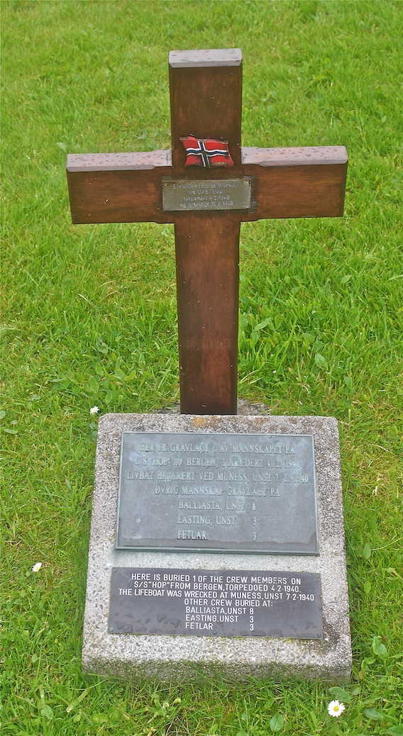
There are other memorials to Norwegian sailers who died during the war. |
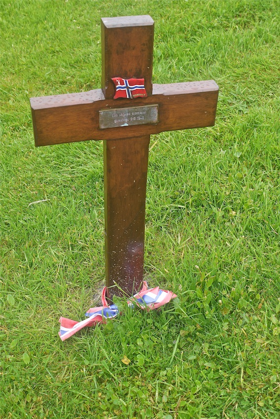 |
I stood a while to take in the scene and think about the sacrifice made by these men.
|
 |
 |
According to the interpretation board, "the so-called Hunter's monument is said to be a place where the laird could check the movements of his fishermen, to make sure they weren't landing catches elsewhere."
|
 |
I left Lunna Kirk in the rain. At the top of the hill I looked back over Lunna Voe and tried to imagine David Howarth's fleet of Norwegian trawlers anchored in the Voe. I fully understood his love for the place and could imagine the impression it made on him for the rest of his life. Cycling on, I really did take his name away in my heart.
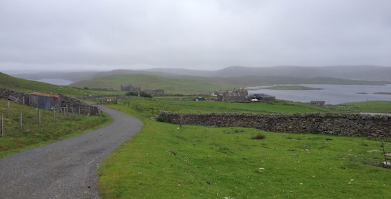
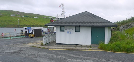
The road undulated its way along the side of the Voe and eventually Vidlin came into view up ahead. I stopped once more at John Herculson's shop, this time leaving the bike outside, not in the bus shelter. |
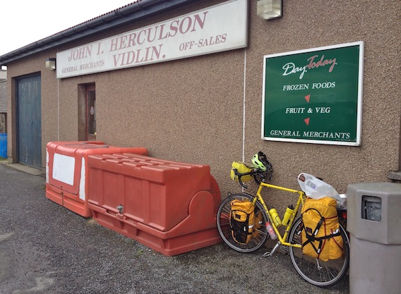 |
I bought another chicken pie, chocolate, milk, some biscuits and a couple of bananas.
Standing in the car park eating my microwaved pie, I noticed that the bus shelter had a load of sandbags on the roof, presumably to stop it taking off. It was only 11.30 am so I was slightly early for the ferry. I intended to have a mooch around Vidlin, but in the end after coasting down the hill, I just rolled on to the ferry terminal.
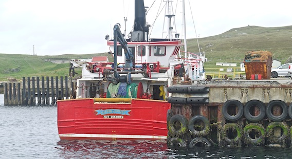
In certain weather conditions and depending on the wind direction, the ferry leaves from Laxo instead of Vidlin. Given my history with Shetland inter-island ferries, I wouldn't have been surprised at all if I'd have been directed back up the hill and on to Laxo. I was pleased therefore to see the ferry tied up attached to the linkspan. |
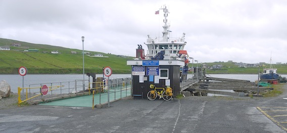 |
The crew were running a hosepipe over the decks. I found my over damp overshoes in a pannier top pocket and left them draped over the crossbar to dry out a bit. I filled up the water bottles from the tap in the waiting room.
|
 |
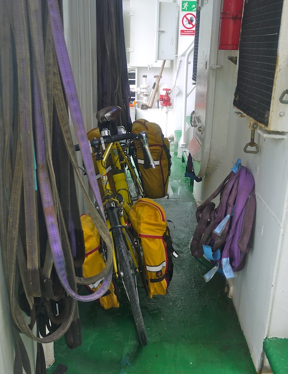
Some cars started to arrive, then the milkman drove onto the car deck to deliver some crates. Eventually, the crew took their places and I was invited aboard. The kind ferry man found a place for the bike behind the 'firewall'.
|
 |
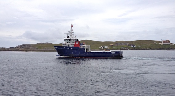
There were only a few other people in the passenger lounge so I had a table and bench to myself under the starboard portholes. These were high up so didn't allow much of a view as the MV Filla pulled smartly off the dock, turned and set off up Vidlin Voe. The other passengers went back to their cars, presumably to have a snooze for the rest of the crossing.
I took the camera and went onto the car deck to watch the scenery go by. We were soon level with Lunna Kirk and Lunna House hiding around the corner. |
 |
 |
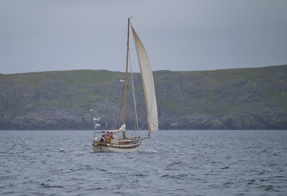
We slowed briefly, I assume to avoid upsetting the fish farm nets, then the ferry picked up speed as the power was re-applied. It was really exhilarating. Further down the Voe, a yacht crossed our path and on closer inspection it turned out to be Norwegian, the Agnes II.
|
 |
The ferry's rolling increased as we rounded Catta Ness and left the shelter of the Voe. I jammed myself between the side and a piece of deck equipment and pointed the camera ahead around the shelter of the superstructure to snap the Skerries island chain out on the horizon.
|
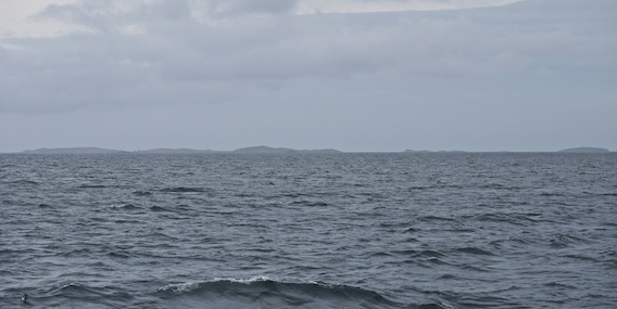 |
The mainland was left behind as our course cut the difference between Lunna Ness edging ever further away to the north east and the north coast of Whalsay to the south. The seascape was spectacular. I went back inside the passenger lounge to switch lenses a few times.
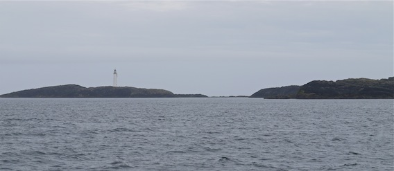
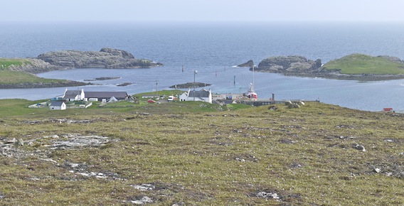
We rounded the north coast of Housay and turned right through 180 degrees around Bruray to approach from the north-east. Flat Lamba Stack passed by on the right as the ferry entered a narrow channel marked by the lighthouse set on its elevated position on Grunay. |
 |
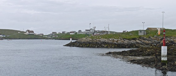
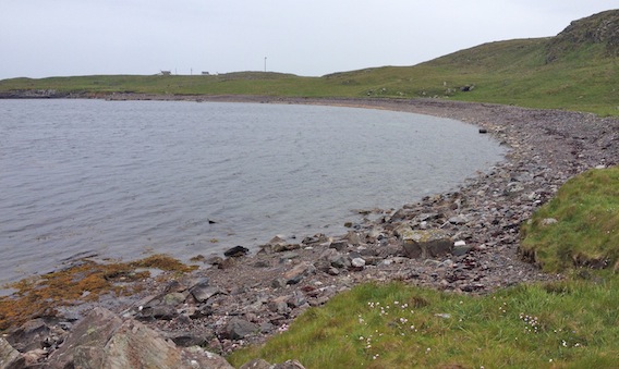
I had a good look at the Lang Ayre beach on the right which I'd identified previously on Google Earth as a possible camping spot. The Northeast Mouth led to the ferry terminal set in its sheltered position round to the right.
|
 |
 |
The cars drove off and I was left to extricate the bike and re-attach the handlebar bag before riding off. There was a lot of interest in the milk crates which soon disappeared in a flurry of vehicles. I said hello to an old guy who'd picked up some of the milk but he didn't respond. I did wonder what I must have looked like, taking a touring bicycle onto an island which had just one short road.
The ferry turn-round was impressive and I only just managed to get out the camera before it steamed smartly away. So that was that, no possibility of leaving again for two days. |
 |
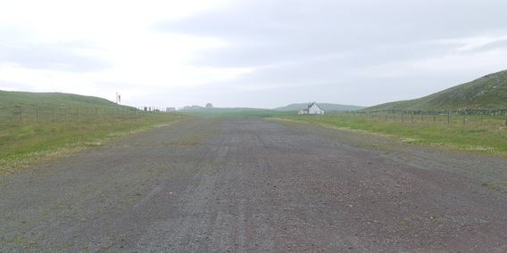
I had something of a plan, which involved a quick end to end cycle tour to get my bearings and have a look around. Then I'd find the air strip as a pointer to the Ayre where I'd hoped to find a suitable camping location, preferably with a sea view.
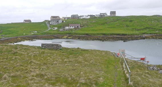
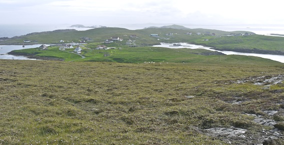
The cycle trip didn't last long. The road snaked around and undulated over some short stiff climbs. The houses are spread over two islands connected by a small bridge. |
 |
 |
 |
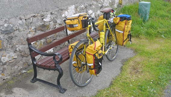
It was very pleasant just mooching around. I exchanged greetings with two women at different points, who were guiding push chairs in the opposite direction. A couple of dead ends later, I reached the western end of the road, where I leant the bike up against a bench by the little cemetery and had a wander down the road.
|
 |
I didn't discover any obvious places to camp better than my original Lang Ayre idea, so I cycled back towards the ferry terminal whilst looking for the airstrip somewhere on the left. I nearly missed the turning, however I soon found a gate and started pushing the bike over the loose chippings.
|
 |
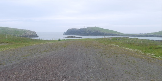 |
Lang Ayre turned out to be not that long, however it was a nice spot with a sweep of pebbles forming a crescent beach.
|
 |
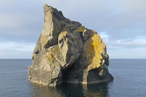
There was a rough path through the grass at the back of the beach which I followed looking for a flat patch. Eventually, I left the bike and hiked the rest of the way up the slope and round the corner to a place that literally took my breath away. I stood for a few seconds in complete awe. I was staring at a huge rock, Lamba Stack, set in a bluey-green sea like an enormous jewel.
|
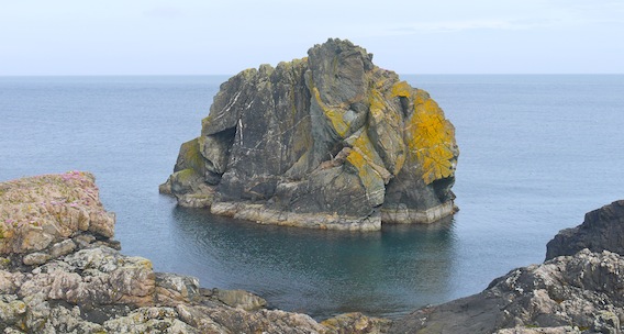 |
Away to my right was the Grunay lighthouse and to the left was Flat Lamba stack; all around was the open sea. A tent sized flat stretch of grass made this a perfect pitch, with a more than perfect aspect. I recovered my senses and went back down the hill for the bike.
Whilst wrestling with the tent's end poles again, I had the distinct feeling of being watched. There was a yacht bobbing around just offshore and the crew seemed to be peering at something. I didn't really think that they'd stopped to watch me put up a tent, but it seemed slightly odd.
Eventually, my camp was set up. I immediately made a brew and found some biscuits. |
 |
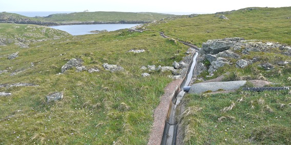
Later, I decided to go for a walk to explore my new surroundings. The obvious route was up the hill behind me to find a birds-eye view from the top of Bruray. I immediately came upon a curious gulley that had been concreted into the hillside, which appeared to spiral round the hill following its contours. The purpose of the gulley became more obvious when I found a pipe emptying into it. Obviously, this was a run-off capture system that channelled water around the hill into the island's reservoir.
|
 |
I caught sight of a large cairn and headed in its general direction. I realised that this was in fact an OS trig point, set in a concrete pillar.
|
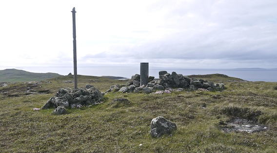 |
My hopes were realised with an all-round panoramic view of the islands set out below in a twinkling sea, with views back to the mainland and out across the North Sea. The sweep of houses from the ferry terminal to the West Voe jetty were nestled below in a tranquil setting.
|
 |
 |
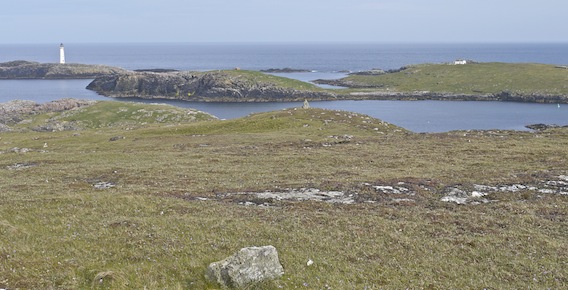 |
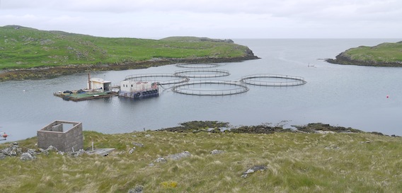
I ventured west towards another cairn and on looking back, discovered that I wasn't alone on the hill. A person was stood at the trig point looking out, just as I had been doing. It turned out that the guy was German and one of the crew from the yacht that I'd seen earlier whilst putting up my tent. He confirmed that they had seen me but that they were really looking at the sea cave under Flat Lamda Stack. They were on a three week voyage and having sailed across from Norway, were overnighting in the harbour before their next leg to Iceland and Faroes.
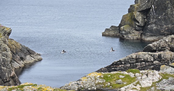
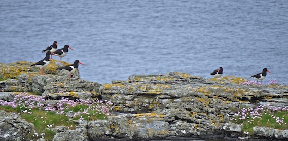
On the way back, I managed to photograph a multitude of birds that were flying around. I was particularly taken with a bunch of oyster catchers that were enjoying the waining sunlight. |
 |
 |
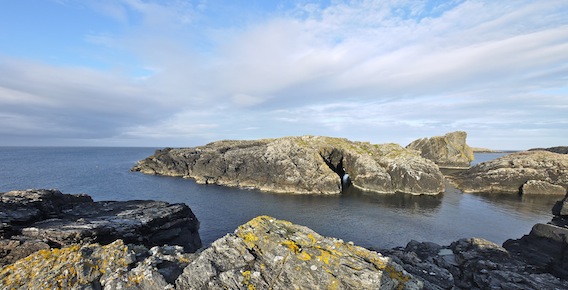
My navigation skills were a bit off and I arrived at the cliffs in front of Flat Lamda Stack. With some scrambling, I could more or less see straight through the sea cave underneath the rock.
|
 |
Back at the camp site, the sun was catching Lamda Stack casting weird shadows across its face.
|
 |
US army MRE rations provided my evening meal; excellent chicken with vegetables, tubed cheese on crackers, chocolate and very palatable coffee. I was mesmerised by the ever-changing light effects, fulmars racing across the cliffs and the utter silence of this wonderful camping spot.
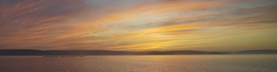
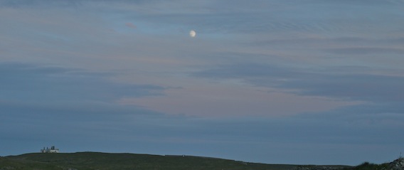
Darkness fell as the sun disappeared behind the horizon leaving a big sky shot through with vivid strokes of red, orange, deep blue and white. A yacht sailed under the light show on a flat calm sea whilst the silvery moon rose high above the lighthouse buildings. |
 |
 |
I retired to my cosy new Alpkit PipeDream 400 sleeping bag. Later I heard foreign voices quite close and assumed that they were the German guy's crew mates on a nocturnal ramble in the pale moon light.
Day four
|