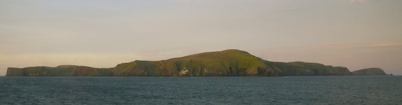
Shetland Islands 2015
On Skerries - Tuesday, 30th June
I awoke chrysalis like in my black Alpkit sleeping bag, snuggled by the down filling. As I lay there contemplating breakfast, for some unknown reason I suddenly had an urge for cornflakes and fresh milk. This grew to such an extent that I realised I'd have to go and buy some.
It had rained during the night and the path down the hill was slippy underfoot. Still, it was nice to be up and about in the cool fresh air and the coastal scenery took on a new aspect in the morning light. I navigated my way towards the harbour, across the airstrip and on down to the shop, which actually took me through what might have been somebody's back garden.
I obviously had no idea about the shop's opening hours, however the door was open so I stepped inside, into the relative darkness. As my eyes adjusted to the gloom, the aladdin's cave nature of the shop gradually became apparent with shelves stacked with every manner of item from food to fashion and hardware to toys. I wandered around, generally feeling the need to duck at various points due to the low ceiling and nearly jumped out of my skin when I spotted the old guy behind the counter. He was the person who'd blanked me when I came off the ferry and didn't seem any more chatty today. I located the cornflakes and milk, together with some local biscuits and took them to the desk. I'm not sure that I paid the price on the box, but then we were in the middle of the North Sea. The guy asked if I needed a bag and I just about managed to understand that he was obliged to charge me 5p for it.
The bag was a wise investment to protect my purchases from the now gentle drizzle that made the trek back just that slightly more tricky. It seems incredible now, but the thought of my new breakfast ingredients filled my senses and I arrived back at the camp site in double quick time. I sat and watched the fulmars racing across the sea whilst consuming two brupot bowls full of cornflakes in quick succession. Eventually my cornflake lust was satisfied and I began to contemplate the day ahead whilst wandering idly northwards drinking a pot of tea and taking-in the wonderful coastline. The views were tremendous and it became obvious that I should take advantage of the dry weather and mount an expedition around the island.
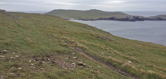
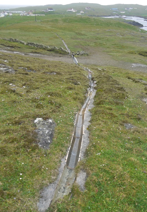
Back at the tent, I loaded up with food rations, Garmin, water, phone and camera and set off north, retracing my earlier steps. I found the water capture gulley again and followed its contours round to the left and came across several breathtaking vistas with long distance sea views, cliffs and birds. |
 |
 |
 |
Eventually the path started to descend and I could see the gully stretching forward and it became obvious that it was heading downhill towards the reservoir.
|
 |
Sure enough, the reservoir came into view, the water held back by its concrete dam.
|
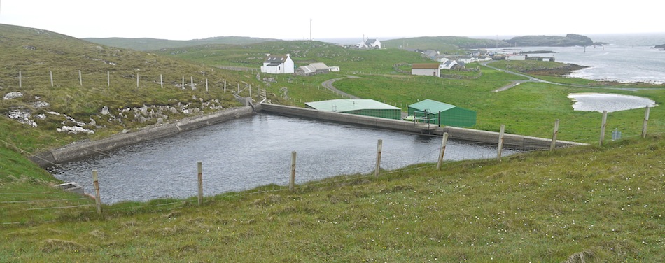 |
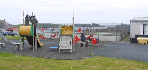
I traversed down the side of the reservoir and round behind the dam to the road at the back. I had seen some interesting circles on Google Earth and had made a mental note to go and investigate and this was now my next objective. Along the road I came across the school and its playground where a film crew had taken up residence on the slide.
|
 |
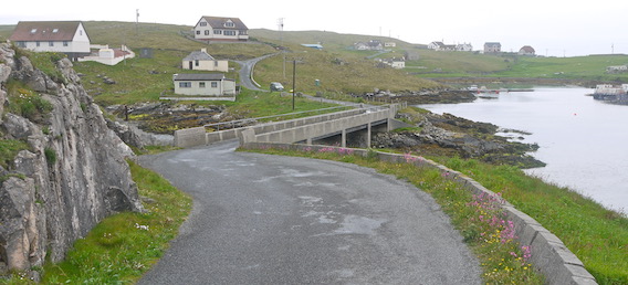
Further on I walked past a number of houses and down across the bridge from Bruray to Housay.
|
 |
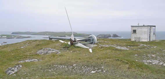
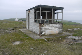
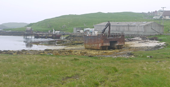
I then struck off left beside a blue industrial shed and up the valley where the circles were situated. They turned out to be five round walls set out in a line in the valley bottom. The next thing to catch my attention was a metal spike pointing to the sky on the horizon up to the left. It wasn't at all obvious what it was. On closer inspection, the fallen rusted wind turbine and its heavenward blade was the first item of dereliction on the hill. The second was the coastguard lookout hut which was in a very sorry state indeed.
|
 |
|
|
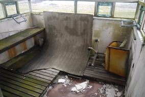 |
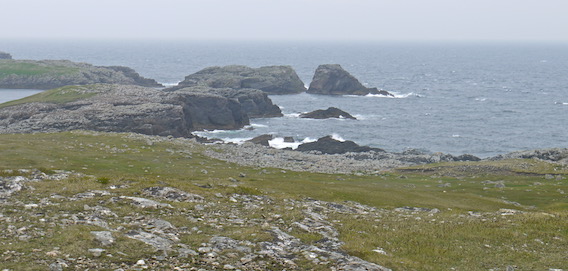
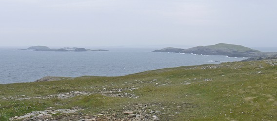
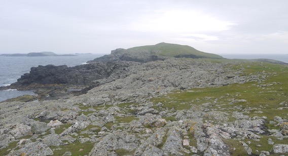
It did however, enjoy a most wonderful coastal view towards sea stacks on the left, all the way round to the Benelip Islands on the right. In front was a landscape strewn with broken rocks.
|
 |
 |
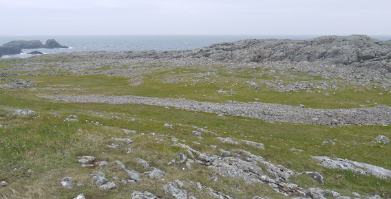 |
I was fascinated by the rock field which included some sizeable boulders, presumably dumped during the ice age to leave this wonderful moonscape.
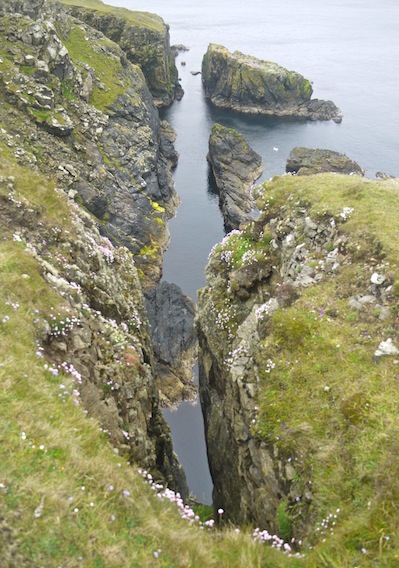
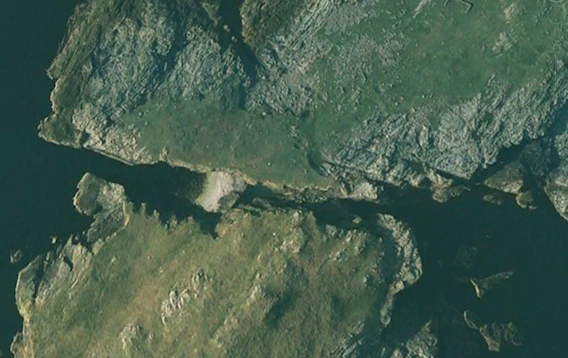
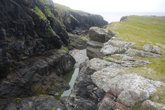
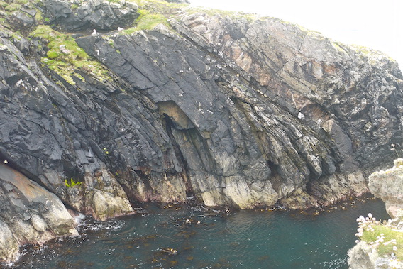
My next aim was to walk south west along the coast to have a look at da Steig, a collapsed cave that separates the island of Mio Ness from the mainland. I'd studied this feature on my OS map and Google Earth to work out whether it was possible to traverse and gain access to the south of Mio Ness. |
 |
My route took me past some breathtaking coastal scenery with deep gullies cut into the rock. Eventually I rounded a headland and dropped down into the valley and onto a rocky beach at the head of a small bay.
|
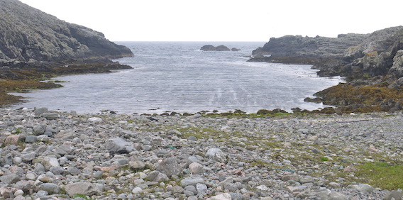 |
I could see the large gash in the land up ahead that marked the location of Da Steig with the bulk of Mio Ness rising beyond. The Benelips glistened on the horizon.
|
 |
As I approached, it became obvious that this feature represented a formidable barrier to any further progress south. The north side dropped down vertically to a rocky valley floor and beach, whilst the south appeared to be a chasm undercut by the sea.
|
 |
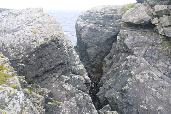 |
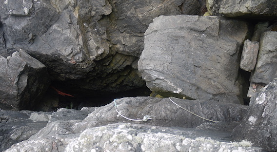
After a mooch around, I discovered a blue rope that ran over the rocks before disappearing tantalisingly over the edge. Ever the explorer, I decided to follow it to see if it offered a possible route down.
|
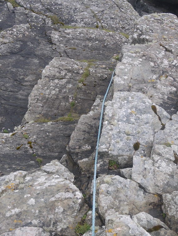 |
The blue rope led around to a rock ledge that appeared to offer a stable platform down to where another rope dangled into the abyss.
|
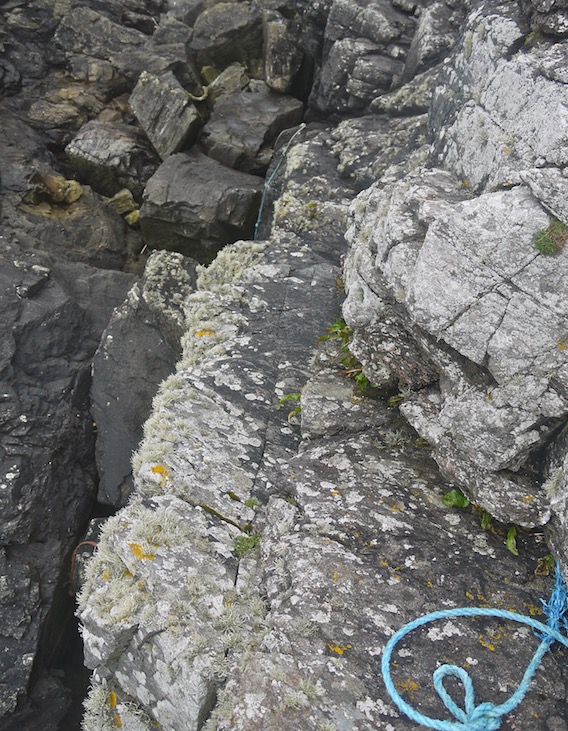 |
Due to the slight dampness of the rock and my lack of mountaineering equipment, it quickly became apparent that this endeavour was not without an element of danger. I jumped off the ledge onto a boulder and lingered for a while to review my options. I appeared to be on top of a rock fall that had become jammed in the gap. There was still a considerable way down to sea level and the ropes looked decidedly ropey, plus it wasn't clear how I'd ascend the other side, nor find a way back.
|
 |
I'd satisfied my curiosity about this feature and witnessed first hand that progress to Mio Ness was a little too precarious for my liking. The weather also seemed to be on the change, so with the sky darkening above, I decided to retrace my steps back up the ledge.
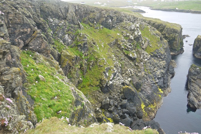
The weather had changed whilst I'd been below and the wind was now pulling at my coat. I headed north with the intention to walk back along that side of Housay. It then became clear how people climb up to Mio Ness having completed the Da Steig mountaineering course. Two ropes were slung down the opposite slope, not for the faint hearted. |
 |
Further on, the rock strata on the opposite side was clearly exposed, inclined and bent through 45 degrees.
|
 |
Then it started to rain, I tucked the camera under my coat and strode off up the coast.
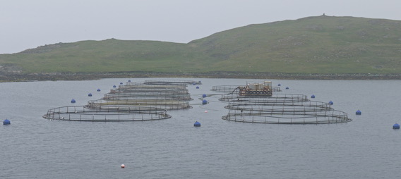
The exposed rocks were similarly inclined giving a sharp edged spiky appearance. I saw a number of sea birds, together with a very cheeky cormorant. My progress was slightly quicker than before, mainly due to the driving rain that prevented any lingering. Eventually, the fish pens in West Voe came into view. |
 |
I had intended to walk to the head of West Voe and up to the north coast for a view of Wether Holm. As I reached the jetty though, the weather became more inclement and I was persuaded to head straight back along the road.
|
 |
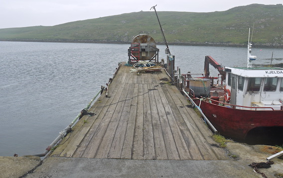 |
On the way back, I noticed a yacht tied up in the harbour, presumably home to the German guy and his mates. The film crew were round the back of the ferry terminal and appeared to be filming a woman throwing rubbish into the skip.
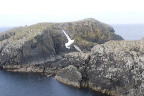
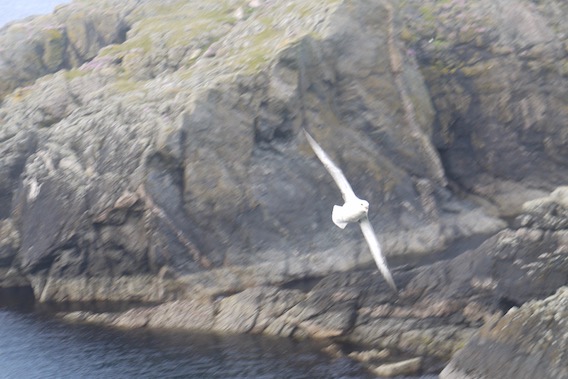
There was a huge gull on Grand Ayre that squawked at me as I passed by. I watched as it rose into the air and swooped off with all the grace of a master flyer in a keen wind. I completed my figure of eight romp around the island and retired to the tent for a short rest. The stormy weather eased so I ventured out to prepare something for tea.
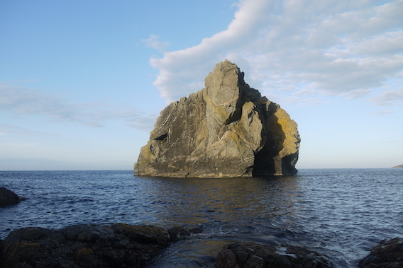
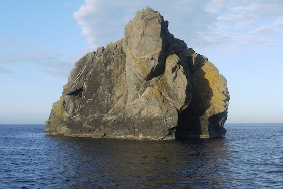
From my lofty perch, I became fixated with two things whilst I ate my rations and drank a mug of tea; the birds and the bulk of Lambda Stack. Fulmars were racing across the gap between me and the rocks opposite with a very interesting swooping motion. I watched as one by one, they leapt off the cliff, disappeared from view before emerging at high speed within a few feet of my face. I attempted to capture this on camera with less than perfect results. |
 |
 |
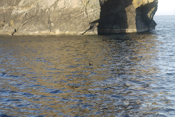
Lambda Stack I realised, changed appearance as the light altered, faded and brightened. I was so fascinated by this that I decided to mount a mini-expedition to get nearer, in order to discover new viewing angles. After a considerable amount of trial and error, and doubling back on more than one occasion, I managed to get down to sea level directly opposite the stack.
|
 |
 |
 |
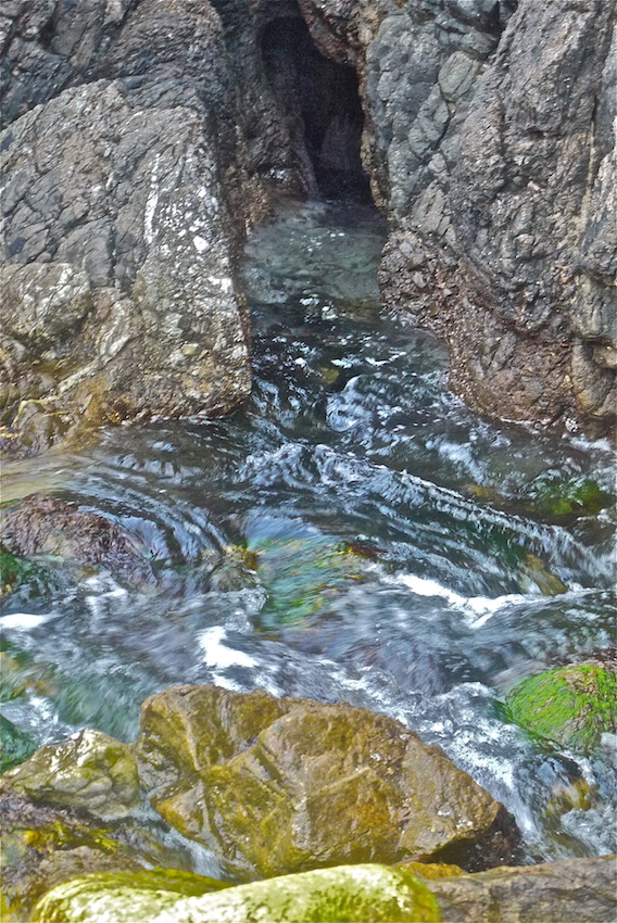
On the way back I found a blow hole, where a cave had been quarried through the rock by the sea and water was rushing back and forth with a satisfying suck and swoosh.
|
 |
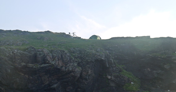
The campsite was silhouetted nicely against the horizon, which reminded me that I should really be finding my way back.
|
 |
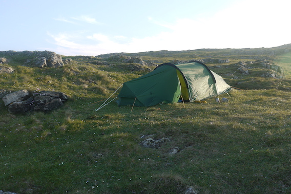
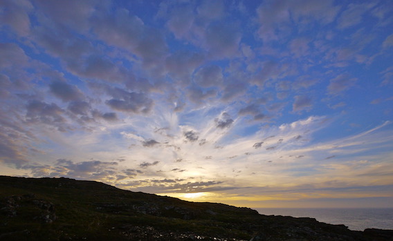
The setting sun cast a golden glow over the tent as I made supper and drank tea from my thermal mug. This was glorious solitude allowing full contemplation of the world and my tiny place in it. I was aware of the broad heavens above and became spellbound by the changing cloud formations against a deepening blue sky.
|
 |
 |
|
|